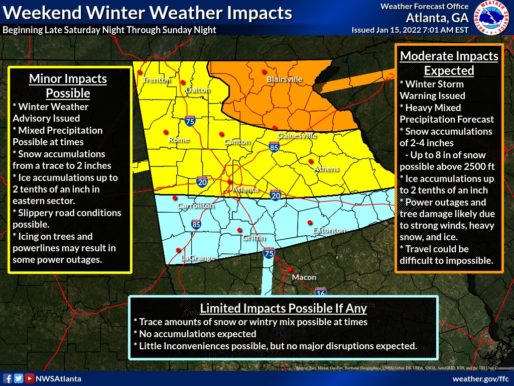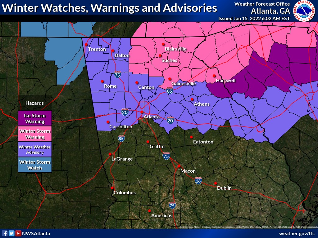
- A Winter Weather Advisory has been issued for West Georgia from midnight tonight through midnight Sunday night.
- Rain mixing with or changing to snow, sleet and freezing rain. Total snow accumulation from 1 – 2 inches. Total ice accumulation from 1/10 to 2/10 of an inch.
- Onset of winter precipitation after midnight tonight, continuing all day Sunday and tapering off by midnight Sunday night.
- Higher snow and ice accumulations will occur further east of our area.
- Make plans for slippery road conditions
- A Wind Advisory has been issued for East Alabama from 1800 hours tonight through 1800 hours Sunday. A Wind Advisory is in effect for West Georgia from midnight tonight through midnight Sunday night.
- As strong low pressure moves across the state, winds will become very strong late tonight and Sunday. Wind gusts of 25 to 35 mph will be common.
- Wind chill values will range from 15 to 25 tonight through Monday morning over much of north Georgia with readings in the teens in the mountains.
- Refreezing of liquid water, or “black ice”, is likely across much of north Georgia and parts of middle Georgia Sunday night and Monday morning.
- These wind gusts along with the accumulations of ice could bring down trees and power lines